


SityTrail - Col de la loge-Supeyres- Tronçon 1

ophness
User
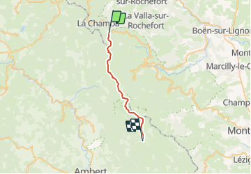

Length
21 km

Max alt
1609 m

Uphill gradient
635 m
Km-Effort
29 km

Min alt
1254 m

Downhill gradient
528 m
Boucle
No
Creation date :
2021-07-18 09:26:36.307
Updated on :
2021-07-18 09:27:21.695
3h52
Difficulty : Medium

FREE GPS app for hiking
 SityTrail
IGN / Geographical institutes
SityTrail Plus
The world is yours!
About
Trail Horseback riding of 21 km to be discovered at Auvergne-Rhône-Alpes, Loire, La Chambonie. This trail is proposed by ophness.
Positioning
Country:
France
Region :
Auvergne-Rhône-Alpes
Department/Province :
Loire
Municipality :
La Chambonie
Location:
Unknown
Start:(Dec)
Start:(UTM)
560636 ; 5065699 (31T) N.
Comments